


Roc des Bœufs et

sandra_leb
User
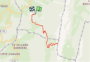

Length
8.7 km

Max alt
1762 m

Uphill gradient
720 m
Km-Effort
18.3 km

Min alt
1023 m

Downhill gradient
721 m
Boucle
Yes
Creation date :
2020-05-21 08:59:44.0
Updated on :
2020-05-21 13:52:31.37
4h19
Difficulty : Difficult

FREE GPS app for hiking
 SityTrail
IGN / Geographical institutes
SityTrail Plus
The world is yours!
About
Trail Walking of 8.7 km to be discovered at Auvergne-Rhône-Alpes, Upper Savoy, La Chapelle-Saint-Maurice. This trail is proposed by sandra_leb.
Positioning
Country:
France
Region :
Auvergne-Rhône-Alpes
Department/Province :
Upper Savoy
Municipality :
La Chapelle-Saint-Maurice
Location:
Unknown
Start:(Dec)
Start:(UTM)
278450 ; 5072296 (32T) N.
Comments
Superbe panorama à l’arrivée Bien escarpe sur la fin Attention à ceux qui ont le vertige